With the fall here, it won’t be long before the leaves start changing, and Pure Michigan is inviting everyone to follow its Pure MI Fall Color Map.
Travel Michigan’s Nick Nerbonne tells us the map is updated daily by a team that closely monitors the emergence of fall colors throughout the state.
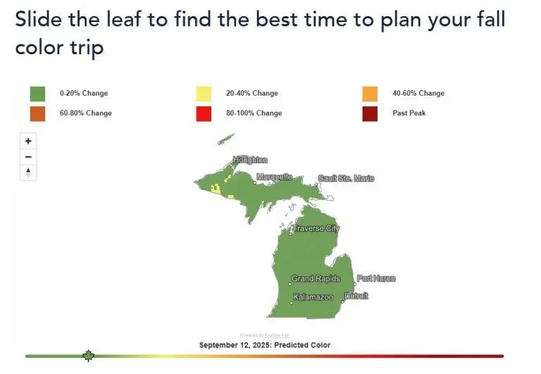
“It’s actually a third party vendor, and they use a combination of historical data and satellite tracking,” Nerbonne said. “So they are monitoring satellite maps and viewing where the progression of fall colors are around the state. And so that is populating into the Fall Color Map.”
With the map, you can use a slider to see a forecast and find out when and where the best fall colors will be found on different dates. As of Friday, only a few small areas of the Upper Peninsula were showing fall colors, but Nerbonne says now would be the time to start planning a trip to the U.P. for the best views.
“The Upper Peninsula has coastline on three different Great Lakes. So you can get fall colors along with the Great Lakes in all different kinds of areas. But there’s also 300 waterfalls in the Upper Peninsula. So the photo ops and the opportunities to explore and see beautiful views are really unmatched.”
Nerbonne says the Fall Color Map can help anyone plan their trip. Travel Michigan hears from people who use it all of the time.
If you’re wondering when Southwest Michigan will get fall colors, the map predicts we’ll start to get the first patches of them around September 26. The peak fall colors should arrive in the area about one month later.